Early-November North Atlantic System
1 resort in the path, 24cm at the biggest. Likely — the models agree on this one.
+24CM
Predicted at Stranda
6–55cm, models far apart
Storm
Nov 8–12
1 resort in the path
Peak
Nov 11
8cm at Stranda
Predicted
24cm
Stranda · 6–55cm, models far apart
Confidence
Likely
Updated
Oct 30, 12:30 UTC
SnowSure Forecaster
Written from the blend and the model spread · updated Oct 30, 12:30 UTC
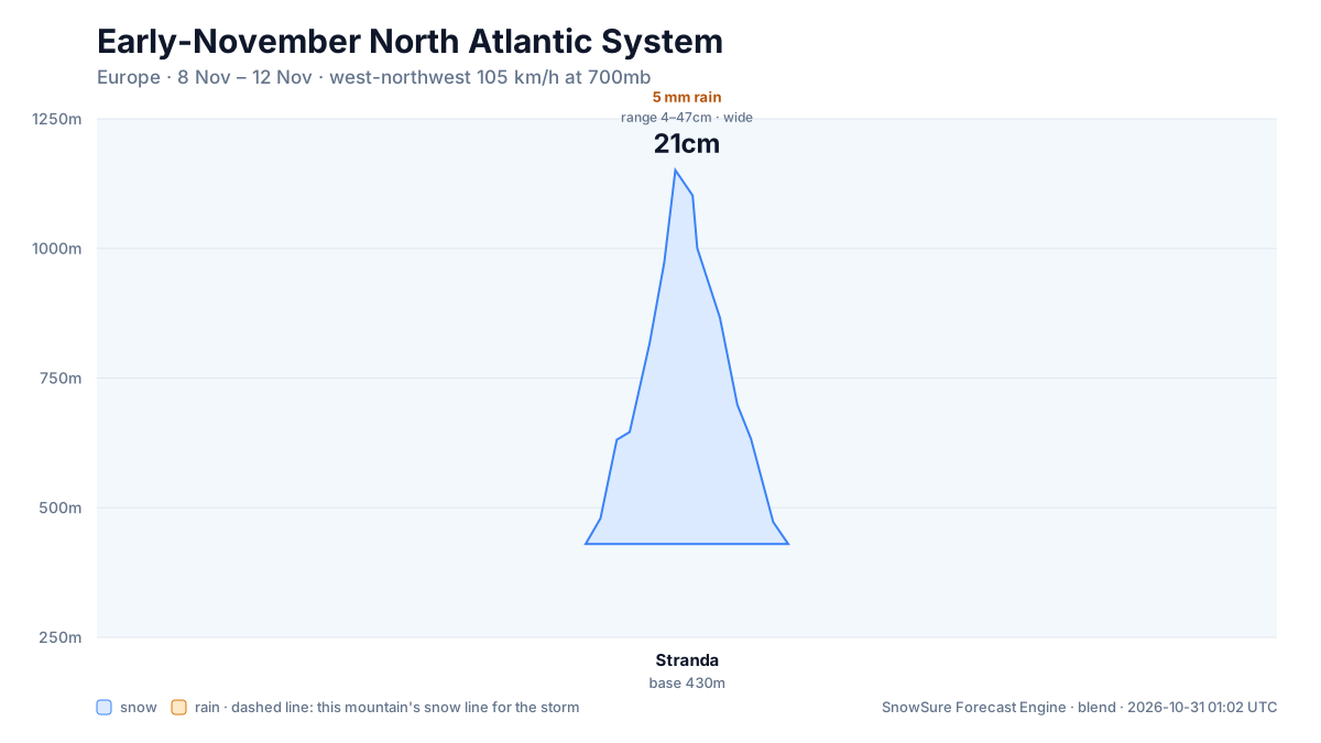
We are watching a significant system for the Alps and wider Europe between 2026-11-08 and 2026-11-12. Stranda carries the biggest signal at 23.6cm over 2026-11-08 to 2026-11-12. At Stranda the freezing level on the snow days sits between base and summit: snow on the upper mountain, rain possible low down. The call changes if model agreement loosens, the window slides later, or the freezing level trends higher.
Snow by day
Nov 7 – Nov 13, with a day either side. For each resort: where the freeze line sits against the mountain, then what falls — snow in cm, rain in mm — and the day read from those two numbers.
Strandabase 430 m · summit 1,151 m
24cm snow1mm rain
Modelled at the summit, 1,151 m · snow above 863 m
linem
/ raincm · mm
Sat
Nov 7
Dry
Sun
Nov 8
Mixed
Mon
Nov 9
Snow
Tue
Nov 10
Snow
Wed
Nov 11
Snow
Thu
Nov 12
Snow
Fri
Nov 13
—
snow Mon, Tue, Wed, Thu · rain low, snow high Sun (above about 863 m)
snowrain low, snow highraindryThe dots are the freeze line — the height where rain turns to snow. Solid: straight from the models. Hollow: estimated from temperature. Above the summit line it rains on the whole mountain; below the base line it snows all the way down. Blue bars are snow in cm, amber bars rain in mm; the totals above are their sums.
Rain / snow line
Base to summit for each mountain, with the snow line cut across them.
The system
700mb flow — where the storm is, and what is steering it. Pins sized by forecast total.
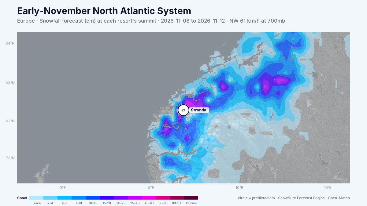
72-hour snowfall forecast for the same window.

In the path
Forecast, not observation — none of this has fallen yet. Totals are across the window. We will post what fell when the window closes.

Last updated 2026-10-30 12:30 UTC. SnowSure scans a blend of seven weather models twice daily and flags systems clearing 30cm over 72 hours, three to fourteen days out. This watch opened on 2026-10-30 with 54cm forecast at Stranda.


